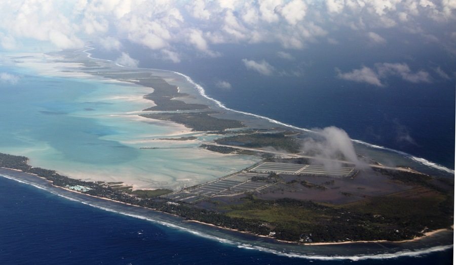
Not long after landing at Bonriki International Airport, however, the true scale comes into focus: the average stretch separating lagoon from ocean can be reached with a golf putter (ok, maybe a nine-iron), and its highest topographical features rise to around knee height on an adult.
Kiribati (pronounced KIH-rih-bahss) has been a member of the United Nations since 1999. It spreads its collection of 33 islands and around 100,000 people over a staggering 1,351,000 square miles of ocean spaced between Fiji and Hawaii.
A drive along the bumpy main road running through South Tarawa’s center — North Tarawa is only reachable by boat — reveals thatch huts perched at the edge of beaches of white sand. Fishermen can be seen tossing nets into the lagoon, and coconut trees provide shade from the blistering sun as women seated at the edge of the road swat flies away from fish resting on scales and shout, “Yellowtail!”
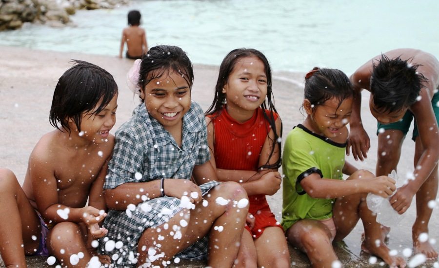
The population, one third of which is located on South Tarawa, is primarily engaged in a subsistence lifestyle. In addition to fishing, foragers collect shellfish in buckets at low tide, while coconuts and breadfruit are harvested and woven crafts are made from tree leaves. The merchants peddling imported canned goods and drinks from roadside stands generally don’t speak English, but a simple greeting of “Mauri” will likely be returned with a smile.
The longest causeway is located at the southern end and breaches the span between the islets of Bairiki, a government administrative district, and Betio, the center of trade. Before crossing, many visitors check in at Mary’s Motel for the best accommodation available on South Tarawa. The air conditioned rooms include a small refrigerator and access (usually) to wireless internet. The grilled fish in garlic served in the motel restaurant is perhaps the best dish on the atoll.
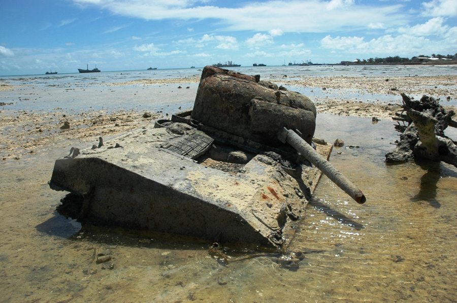
Betio is most famous for its role in World War II, when Allied and Japanese forces tore across the landscape for three days of intense fighting in 1943. By the end, only a charred chunk of earth remained and over 6,000 lives had been lost, making it one of the most brutal battles in US military history.
Though it resembles a stereotypical Pacific Island paradise, Tarawa is no idyll. Frills are nonexistent, and space is at a premium, making garbage disposal a huge problem. Furthermore, the high population density — especially on Betio — and inadequate sanitation systems have rendered the waters off South Tarawa generally unsuitable for swimming.
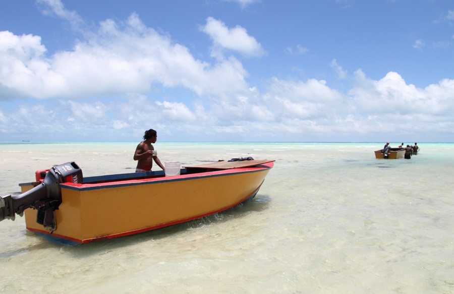
For those seeking that tropical treatment, though, there is North Tarawa. Boats make the one-hour journey from Bairiki multiple times each week, and snorkeling, fishing and picnicking possibilities abound. It’s the best place to experience, as the locals say, “Te mauri, te raoi, ao te tabemoa” (Health, peace and prosperity).